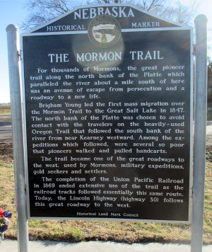
Nebraska Historical Marker: The Mormon Trail 006
Nebraska Historical Marker: The Mormon Trail
Location
Corner of U.S. 30 & M road, Central City, Central City, Merrick County, Nebraska
View this marker's location 41.10494, -98.0202
View a map of all Nebraska historical markers, Browse Historical Marker Map
Marker Text
For thousands of Mormons, the great pioneer trail along the north bank of the Platte which paralleled the river about a mile south of here was an avenue of escape from persecution and a roadway to a new life.
Brigham Young led the first mass migration over the Mormon Trail to the Great Salt Lake in 1847. The north bank of the Platte was chosen to avoid contact with the travelers on the heavily-used Oregon Trail that follows the south bank of the river from near Kearney westward. Among the expeditions which followed, were several so poor that pioneers walked and pulled handcarts.
The trail became one of the great roadways to the west, used by Mormons, military expeditions, gold seekers and settlers.
The completion of the Union Pacific Railroad in 1869 ended extensive use of the trail as the railroad tracks followed essentially this same route. Today, the Lincoln Highway (Highway 30) follows this great roadway to the west.
Further Information
Bibliography
Marker program
See the Nebraska Historical Marker Program for more information.
