Nebraska Historical Marker: Phelps County
Location
701-749 5th Ave, Holdrege, Phelps County, Nebraska
View this marker's location 40.439180, -99.37061
View a map of all Nebraska historical markers, Browse Historical Marker Map
Marker Text
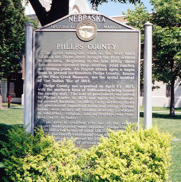
The great immigrant roads to the West which followed the Platte River brought the first settlers to this area. Beginning in the late 1850's, these frontiersmen operated stage stations, road ranches, and trading posts. An August attack upon a wagon train in present northwestern Phelps County, known as the Plum Creek Massacre, was the initial incident of the Indian War of 1864. Phelps County was organized on April 23, 1873, with the northern town of Williamsburg being named the county seat. The seat of government was moved to Phelps Center in 1879 and again to Holdrege, its present location, in 1883. Early settlers, lured by government homestead lands and cheap railroad lands, were mainly of Swedish descent. Excellence in education, religion, and agriculture was their goal, as it is today. This area is credited with one of the world's largest underground water supplies. Phelps County is 348,000 acres in size of which 338,300 are farmland. In 1973, the county's centennial year, over 62% of its cropland is watered by 1,041 irrigation wells and over 350 miles of ditches and laterals.
Further Information
Bibliography
Elton A. Perkey, “Perkey’s Nebraska Place Names” (1995), Nebraska State Historical Society
Marker program
See Nebraska Historical Marker Program for more information.


