Difference between revisions of "Nebraska Historical Marker: Pleasant Hill"
From E Nebraska History
m |
|||
| Line 6: | Line 6: | ||
View this marker's location '''[https://maps.google.com/maps?q=40.587126,+-97.09416&hl=en&sll=40.644454,-97.11471&sspn=0.006781,0.009645&t=h&z=15 40.587126, -97.09416]''' | View this marker's location '''[https://maps.google.com/maps?q=40.587126,+-97.09416&hl=en&sll=40.644454,-97.11471&sspn=0.006781,0.009645&t=h&z=15 40.587126, -97.09416]''' | ||
| − | + | {{Marker:Map}} | |
==Marker Text== | ==Marker Text== | ||
| Line 15: | Line 15: | ||
==Bibliography== | ==Bibliography== | ||
| − | + | {{Marker:Program}} | |
| − | + | ||
Revision as of 12:56, 12 September 2017
Location
Rural County Road Hh, Dorchester, Saline County, Nebraska
View this marker's location 40.587126, -97.09416
View a map of all Nebraska historical markers, Browse Historical Marker Map
Marker Text
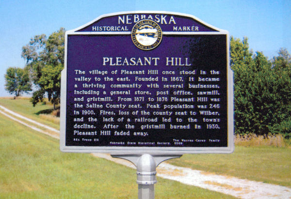
The village of Pleasant Hill once stood in the valley to the east. Founded in 1867, it became a thriving community with several businesses, including a general store, post office, sawmill, and gristmill. From 1871 to 1878 Pleasant Hill was the Saline County seat. Peak population was 246 in 1900. Fires, loss of the county seat to Wilber, and the lack of a railroad led to the town's decline. After the gristmill burned in 1930, Pleasant Hill faded away.
Further Information
Bibliography
Marker program
See Nebraska Historical Marker Program for more information.
