Difference between revisions of "Nebraska Historical Marker: Indian Treaty Monument"
(→Location) |
|||
| Line 2: | Line 2: | ||
==Location== | ==Location== | ||
| − | + | Centennial Avenue near North Table Creek, .4 mile south of Bus.75, Nebraska City, Otoe County, Nebraska | |
View this marker's location '''[https://maps.google.com/maps?q=40.691518,+-95.88478&hl=en&ll=40.691621,-95.88482&spn=0.006955,0.013937&sll=40.673584,-95.872171&sspn=0.006957,0.013937&t=h&z=17 40.691518, -95.88478]''' | View this marker's location '''[https://maps.google.com/maps?q=40.691518,+-95.88478&hl=en&ll=40.691621,-95.88482&spn=0.006955,0.013937&sll=40.673584,-95.872171&sspn=0.006957,0.013937&t=h&z=17 40.691518, -95.88478]''' | ||
Revision as of 12:21, 28 September 2017
Location
Centennial Avenue near North Table Creek, .4 mile south of Bus.75, Nebraska City, Otoe County, Nebraska
View this marker's location 40.691518, -95.88478
View a map of all Nebraska historical markers, Browse Historical Marker Map
Marker Text
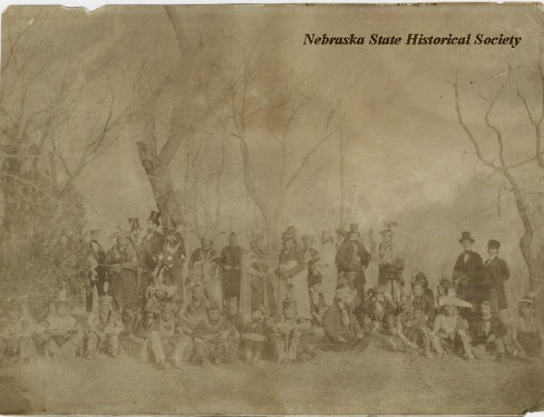
Table Creek Treaty with Pawnee Indians, September 24, 1857
Erected 1933 to commemorate the treaty made with the Pawnee Tribe at Rocky Ford on North Table Creek, 1000 feet east of this site, establishing permanent friendly relations with the Pawnee Indians and insuring safety, prosperity and happiness to the pioneer white settlers. Assembled under the Treaty tree and participating in the treaty were the following named white men, and the Indian chiefs whose names are on the foundation stones. James W. Denver, United States Commissioner; N. W. Tucker; Wm. W. Dennison, United States Indian Agent; Will E. Harvey; A. S. H. White, Secretary to Commissioner; O. H. Irish; Samuel Allis, Interpreter; J. Sterling Morton.
Further Information
Bibliography
Marker program
See Nebraska Historical Marker Program for more information.
